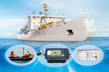
Single beam and Multibeam Echosounder Survey
Yolax Infranergy survey group has engaged in providing service of hydrographic surveying with EchoSounder to further upgrade its technical competency. As the leading survey and dredging service providers we also have echosounder survey service to offer a suite of solutions that support all type of work for civil engineering & dredge operations. We provide survey with single beam echosounder and multibeam echosounder systems for seabed mapping. Our inventory of ecosounder and related equipments enhances our already extensive fleet of equipment with the best of swathe technology. We offer integrated system solutions, rental services and technical support to a wide range of segments, covering Hydrographic & Geophysical Survey, Surface & Underwater Positioning, ROV Sensors, Meteorology and Oceanography.
Single Beam EchoSounder
Single beam Echosounders are used to measure the depth to the seafloor by using the properties of acoustic waves. There are different scenarios where using a single beam echosounder uch as lagoons and lakes where the use of multibeam would have no advantage. It is very useful for defining seagrass areas and measuring the height, position and density of these vegetations. This can be advantageous for environmental requirements with subsequent surveys revealing the growth or degradation over time. Our single beam system is equipped with a double recurrence transducer with high frequency that generates a first return on the signal and delineate the seabed, ocean grass, shake and so on.
Multibeam EchoSounder
Multibeam echosounders (MBES), like other sonar systems, transmit sound energy and analyze the arrival flag (reverberation) that has bounced off the seafloor or other objects. multibeam echosounder survey transmit sound waves from directly beneath a ship's structure to deliver fan-molded inclusion of the ocean bottom. MBES has a more than one transducers that enable a substantial swath of area to be surveyed at once making studying a lot quicker and more accurate.
Our multibeam echosounder are equipped for integration with other acoustic instruments and can be used as subsystems in integrated survey instrumentation solutions, involving centralized synchronization of the transmission sequence and Marine Data Management. Our highly qualified team has a strong foundation in establishment research for the marine environment. Marine multibeam echosounder provides imaging and mapping ability from the most elevated goals of deep/shallow water systems for small vessels, AUVs and ROVs the whole distance to the full sea systems for deep water mapping and scientific research. Our multibeam echosounder provides imaging and mapping capability of high resolution in deep/shallow water systems.
The hydrographic survey services provided by us are-
- Mapping of harbors, inland conduits and shipping channels with basic bottom clearance
- Refilling operations to screen and gauge the positions of covering materials to secure commercial infrastructures.
- Detection and mapping of flotsam, jetsam and other underwater objects
- Mapping of biomass in the water column
- Monitor and measure the positions of covering materials to ensure business infrastructures.
- Progress surveys which involve underwater construction work or dredging
- Natural seabed and living space mapping